by Hamza Javed - perjantaina 19. heinäkuuta 2024, 12.29
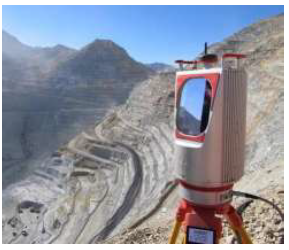
Terrestrial laser scanning (TLS) is a method of remote sensing method that derives high resolution 3D models from 2D image sequences. It acquires coordinates of points by emitting laser pulses towards them and measuring the distance from the device to the target. It is also called LiDAR (Light ranging and detection).